








Kolkata
KMC Building Plan Sanction for a Bungalow on a Large Plot in Kolkata
How the KMC sanction file actually behaves on a large residential plot, what it needs, where it stalls, and how our studio runs it.
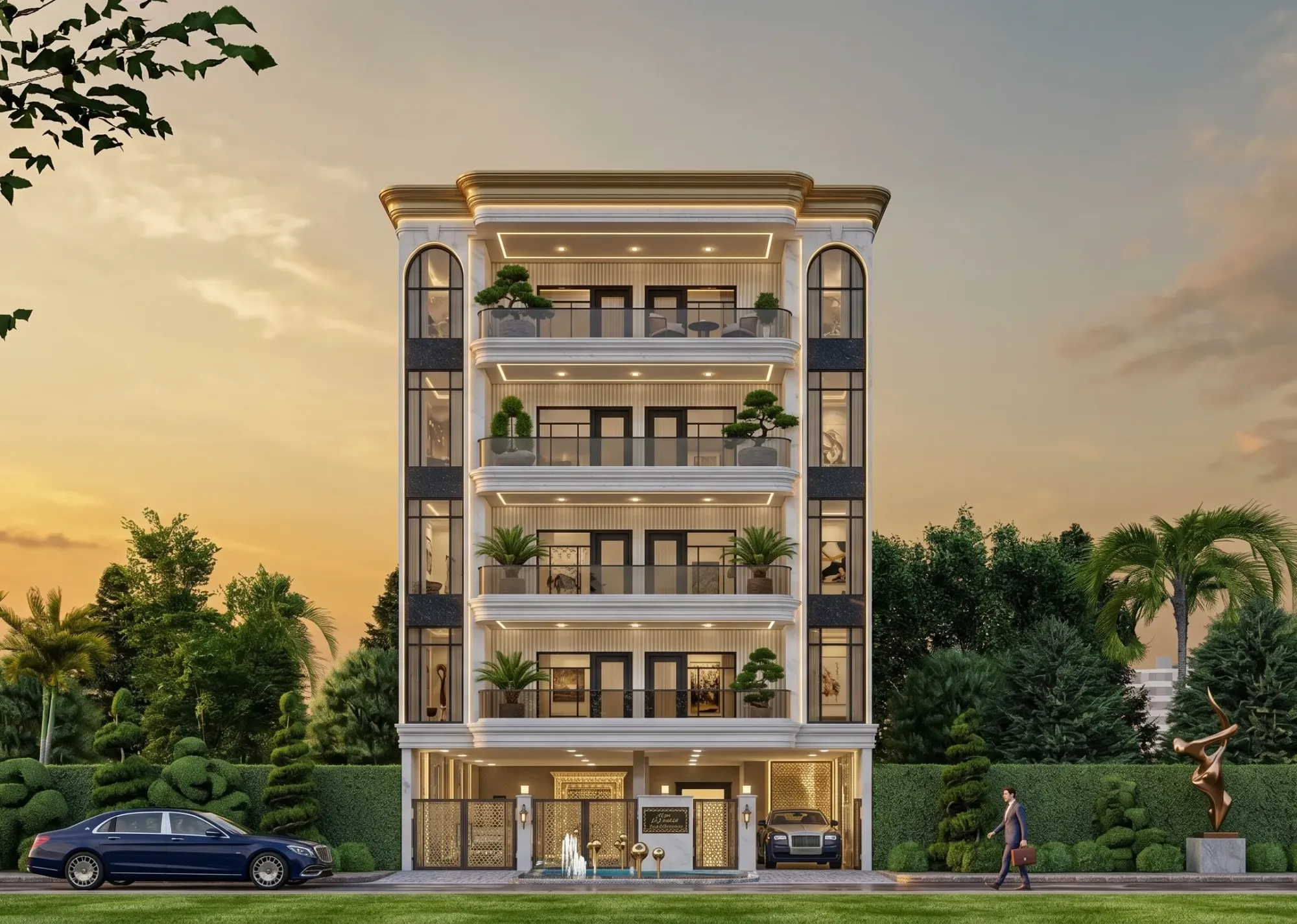
A bungalow on a large plot inside the Kolkata Municipal Corporation area is a very particular kind of sanction case, and people usually underestimate it because they assume a low-rise house on a generous piece of land is the easy version of the problem. It is not, and the reason is simple enough once you have run a few of these, because a large plot almost always carries more history on paper than a small one, so the deed chain is longer, the amalgamation or subdivision story is messier, the physical boundary on site has drifted from the boundary on the record over the decades, and every one of those things surfaces at the scrutiny stage rather than at the design stage where it would have been cheap to fix.
We are Studio Contour, an architecture and interior design practice based in New Town, Kolkata, running since 2014, and we have delivered 330 plus buildings across New Town, Salt Lake, Rajarhat and greater Kolkata. Our principal architect Sumana Kumar takes residential and commercial projects through the NKDA, KMC and Bidhannagar Municipal Corporation sanction processes as ordinary working routine, which means the observations in this guide come from files we have actually pushed rather than from a rulebook summary. This piece walks through what the scenario really involves, the document and drawing set you should assume you need, the realistic stage sequence, the specific things that stall a large-plot bungalow file, and how our studio runs it.
One hard rule before anything else, and we want it up front rather than buried at the bottom. We are deliberately not quoting exact FAR multipliers, exact setback distances in metres, exact fee slabs or exact statutory turnaround days in this guide, because those figures move with plot category, abutting road width, zone and periodic amendment, and a number that was correct for a neighbour's plot two streets away can be wrong for yours. Treat every figure here as an illustration of how the arithmetic behaves, and confirm the live numbers for your specific plot with the relevant authority or through your architect before you commit to a design.
What this sanction scenario actually involves
A large plot changes the shape of the problem rather than the difficulty of it. On a small urban plot the design is squeezed, the permissible envelope is tight, and the whole exercise is about extracting a workable house from very little room, so the sanction question is basically whether you have stayed inside the box. On a large plot the permissible envelope is usually bigger than the house the client actually wants, which sounds like freedom and is exactly where files go wrong, because the constraint stops being area and starts being everything else, right. Mandatory open space on every side has to be genuinely clear and not quietly occupied by a ramp or a utility block, the access road width governs a great deal of what you are entitled to, parking has to be shown as real usable bays with real manoeuvring space rather than as hatching on a plan, drainage and rainwater disposal on a wide site has to be resolved on the drawing, and the built form has to sit correctly against the recorded boundary and not against the wall the previous owner built.
The floor area ratio arithmetic is worth explaining as a concept because clients consistently misread it. FAR is permissible built-up area expressed as a multiple of plot area, so on a bigger plot the same multiple yields a much larger absolute entitlement, and for a two storey bungalow you will very often be nowhere near using it. That surplus is not wasted, it is leverage, because it means you can place the mass where the site actually wants it instead of where the maximum forces it, and you can hold generous ground coverage in reserve for a future block or a guest wing without redesigning the approved scheme. Ground coverage is the separate limit that governs footprint rather than total area, and on large plots ground coverage plus open space, not FAR, is usually the binding constraint on how the house sits.
The document set and the drawing set
Split these two mentally, because they fail for different reasons. The document set fails on ownership and record consistency, and the drawing set fails on technical compliance and internal contradiction, and the two failures need different people to fix them.
On documents, assume you need clean and current title evidence, the full deed chain including any amalgamation or partition history, the mutation and current property assessment record in the present owner's name, up to date tax clearance, and the current certified plot record showing the boundary as the authority holds it. On a large plot, the item that most often is not ready is mutation, because families hold ancestral land for decades without updating the record after a succession or a partition, and the applicant name on the sanction paperwork then does not match the name on the record. That single mismatch can hold a file longer than any design issue.
On drawings, assume a site plan showing the recorded boundary with dimensions and the abutting road with its width, a layout plan showing the building placed within the plot with every open space dimensioned, floor plans for each level, sections through the significant conditions including any level change, elevations, a roof plan, and the service layouts covering drainage, water and rainwater disposal. Structural drawings and the associated reinforced concrete design details come alongside, signed by the appropriate professional. Every one of these has to agree with every other one, which sounds obvious and is the thing that most commonly breaks, because a late plan revision that never propagated into the section or the area statement reads to a scrutinising officer as a file that was not checked before it was submitted.
- Current title deed and full ownership chain
- Mutation and property assessment in the present owner's name
- Latest tax clearance
- Certified plot record showing recorded boundary
- Site plan with abutting road width marked
- Dimensioned layout plan showing all open spaces
- Floor plans, sections, elevations and roof plan
- Drainage, water and rainwater disposal layouts
- Structural drawings signed by the appropriate professional
- Area statement reconciled against every drawing
The realistic stage by stage sequence
The sequence below is how these files actually move rather than how a flowchart says they move, and the difference matters because clients plan their finances against the flowchart and then get surprised.
First comes the pre design verification, and this is the stage almost everybody skips. Before we draw anything we establish what the record says about the plot, what the abutting road width is, and what the entitlement therefore is, and on large plots we also physically verify boundary against record. It is common on older large holdings to find a foot or two of drift on one side, and finding that at survey stage costs a week, whereas finding it after submission costs a resubmission.
Second is the concept and compliance design, where the house takes shape inside a verified envelope rather than a guessed one. Third is the full sanction drawing set with the structural package, prepared to be internally consistent. Fourth is submission with the assembled document set. Fifth is scrutiny, where queries come back, and you should plan for at least one round of queries as the normal case rather than as failure. Sixth is compliance and reissue, seventh is sanction, and eighth, much later, is completion and occupancy, which has its own document set and which you should be designing towards from day one instead of treating as an afterthought.
- 01Pre design verification of record, boundary and road width
- 02Concept design inside a verified envelope
- 03Full sanction and structural drawing set
- 04Submission with assembled documents
- 05Scrutiny and query round
- 06Compliance and reissue
- 07Sanction
- 08Completion and occupancy
What actually causes rejection or delay in exactly this scenario
We see the same handful of causes repeatedly on large-plot bungalow files, and almost none of them are about architecture.
Ownership record mismatch leads, as covered above. Boundary discrepancy between the physical site and the recorded plot comes second, and it is disproportionately a large-plot problem because old boundary walls, encroaching neighbours and informal adjustments accumulate over decades on land that nobody has measured in a generation. Third is access road width being assumed rather than verified, which is dangerous because road width often governs entitlement, so an assumption here quietly invalidates the whole scheme rather than one drawing. Fourth is open space being nominally shown but functionally occupied by a generator yard, a ramp, a servant block or a compound structure that was drawn casually. Fifth is parking shown as an area rather than as usable bays with a real turning path, which reads as non compliant even when the total square footage is fine. Sixth is the internal contradiction problem, where the area statement, the plans and the sections disagree after a revision. Seventh, and this one is specific to generous sites, is the outbuilding, staff quarter, gate structure or boundary treatment that the client considers incidental and the file considers built area.
The catch here is that six of those seven are discovered at scrutiny and fixed by resubmission, and each resubmission round costs weeks that nobody budgeted. Our position is that the money and time you spend on verification before the first line is drawn is the cheapest time in the entire project.
| Verify before designing | Design first, verify later |
|---|---|
| Entitlement is known before concept | Entitlement is assumed and may be wrong |
| Boundary drift found at survey | Boundary drift found at scrutiny |
| Query rounds are minor and technical | Query rounds force redesign |
| Cost of correction is a few days | Cost of correction is weeks per round |
How Studio Contour runs it
We run these files as one continuous piece of work rather than as a design job followed by a paperwork job, because the two are the same job and separating them is what produces contradictions. Practically that means our first deliverable on a large-plot bungalow is not a plan, it is a verified position on what the plot is, what the record says, what the road width is and what the entitlement therefore comes to, and only then do we design.
Sumana's view on this, and it is the studio position we will stand behind, is that a sanction drawing set is a design document rather than a formality, so the house you get approved should be the house you actually want to live in, because a scheme drawn to clear scrutiny and then quietly changed on site turns into an occupancy problem two years later. On generous plots we design the whole intent up front including any second phase, get it coordinated, and let the client build in stages against an approved scheme rather than approving twice.
We also front-load the visual understanding, because on a large plot the difference between two compliant placements of the same house is enormous and it is very hard to feel from a plan. Our 3D visualization and rendering work runs alongside the sanction set for exactly that reason, and it sits inside our broader residential architecture practice rather than being sold as a separate exercise. If you want the wider procedural context, our guide to the KMC building sanction process in Kolkata covers the mechanics end to end, the piece on KMC building rules and FAR in Kolkata explains how the entitlement arithmetic behaves, and the West Bengal building rules overview frames how the different authorities relate to one another. For the commercial side of the conversation, our note on architect fees in Kolkata sets out how fees are actually structured on this kind of project, and our Kolkata architect registration verification guide explains how to check the credentials of whoever you hire, which we would recommend you do with us as well as with anyone else. The Chinar Park bungalow in Kolkata is a useful reference for how a low-rise house sits on a generous site once these constraints are resolved properly.
At the end of the day, a large-plot bungalow sanction in Kolkata is not a hard file, it is a file with a lot of surface area for small errors, and the practices that keep it clean are boring and verifiable rather than clever. Verify the record before you design, measure the boundary before you commit to a setback, confirm the current figures for your specific plot with the authority rather than borrowing your neighbour's numbers, and keep the drawing set internally consistent through every revision.
If you have a plot in the KMC area and you want the entitlement position established before you fall in love with a plan, talk to us and we will start with the record and the boundary rather than with the elevation.