








NKDA & New Town Rules
NKDA Building Plan Sanction for a Bungalow on a Large Plot in New Town
How a single-family bungalow on a large New Town plot actually moves through NKDA sanction, from title papers to the approved drawing set.
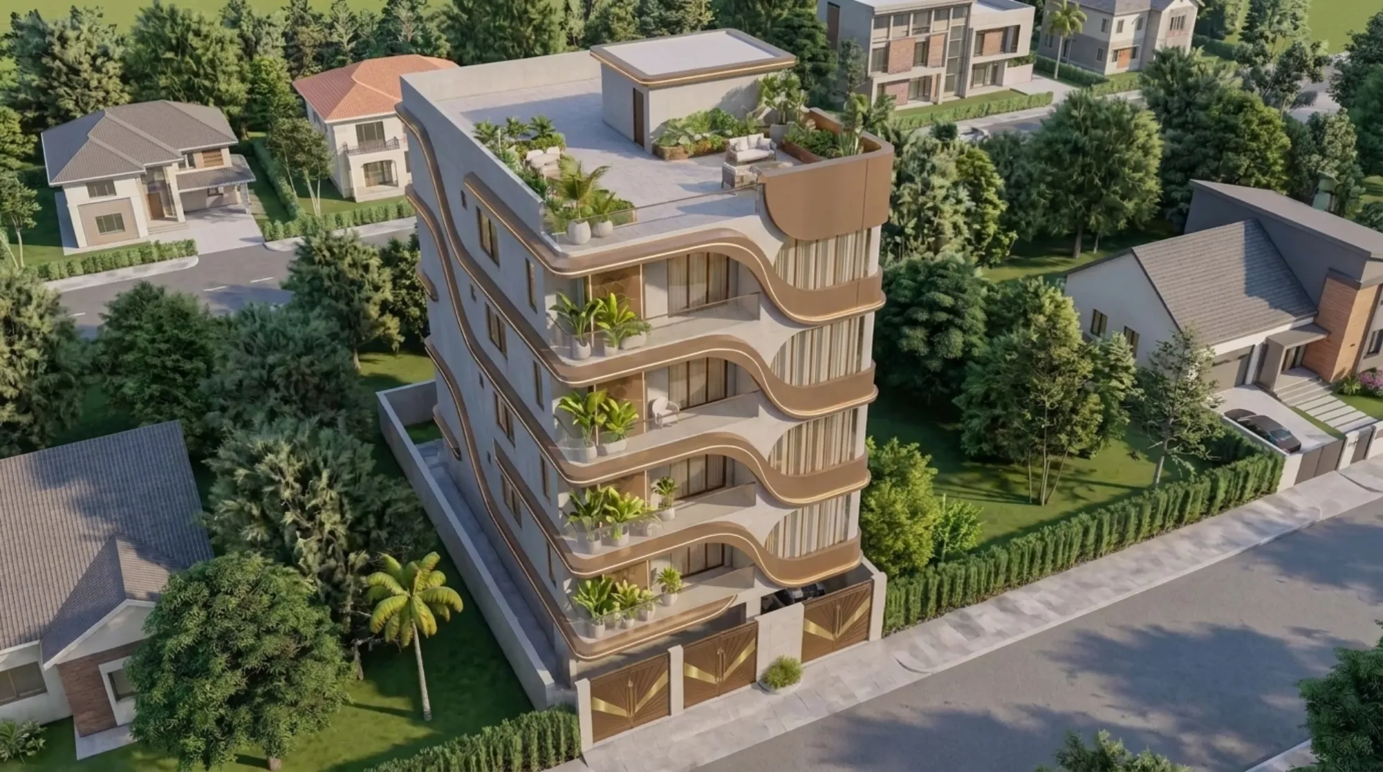
A bungalow on a large plot is one of the few building types in New Town where the sanction file is genuinely different from everything around it, and most owners do not realise that until they are already three weeks into the process. The stack of apartment blocks and G+4 buildings going up on standard plots follows a fairly rehearsed path, the drawings look similar to each other, the queries that come back are familiar, and the file moves. A low-rise single-family house sitting on a plot that is two, three, sometimes four times the standard size is a different animal, because you are usually nowhere near the permissible envelope, the ground coverage question becomes a design question rather than a compliance squeeze, and the scrutiny shifts onto things people rarely prepare for, like how the plot was amalgamated, whether the approach road width on record matches what is actually built, and whether the site plan you have drawn agrees with the possession documents you have submitted.
We are Studio Contour, an architecture and interior design practice working out of New Town, Kolkata since 2014, and we have delivered 330 plus buildings across New Town, Salt Lake, Rajarhat and greater Kolkata. A meaningful share of that is exactly this scenario, the large-plot residence, and the pattern we see is consistent enough that it is worth writing down properly rather than leaving owners to piece it together from hearsay at the site office.
One thing to fix before we start. This guide explains concepts and process, not statutory numbers. Floor area ratio, ground coverage, setback dimensions, height caps and fee heads all vary by plot category, abutting road width and zone, and they get revised, so any figure below that looks like a number is an illustration to explain the mechanic and nothing more. For your specific plot, the current figures come from the authority and from your architect reading the current rules against your actual documents.
What this sanction scenario actually involves
When we say large plot bungalow, we mean a plot where the permissible built-up area comfortably exceeds what the family wants to build, and that inversion changes everything about how the file is prepared. On a tight plot the architect is fighting for every square foot, the design is essentially the maximum envelope with rooms carved out of it, and the sanction drawing is a defence of that maximum. On a large plot you are voluntarily under-utilising, so the drawing has to make the restraint legible, the open areas have to be shown as designed open areas with a purpose rather than as leftover ground, and the case you are making to the scrutiny officer is that the proposal sits comfortably inside every limit rather than scraping past one.
The mechanics that govern the envelope are worth understanding in plain terms. Floor area ratio is the multiplier applied to your plot area that gives you the total floor area you are allowed to build, and it is not a single universal number, it moves with plot size band, land use and the width of the road your plot abuts, which is why two neighbours on the same street can hold different entitlements. Ground coverage is a separate cap on how much of the plot the building footprint may occupy at ground level, and on a bungalow this is usually the binding constraint rather than FAR, because a house that spreads horizontally eats coverage fast while barely touching its floor area entitlement. Setbacks are the mandatory clear distances from each boundary, they scale with building height and road width, and on a large plot they are rarely the problem, though they become one the moment somebody decides to attach a covered car porch or a guard room to the compound wall. We have written the detail out separately in our guides on FAR and ground coverage rules in New Town and on setback and open space rules, and it is worth reading both before your first design meeting rather than after.
The document set and the drawing set
These are two separate bundles and owners consistently underestimate the first one. The drawings are our job and they get done. The documents are the owner's job, they depend on registrars, tax offices and sometimes on relatives, and in our experience they are the single largest determinant of whether a file takes weeks or months.
On the ownership and title side you are assembling the registered deed and the chain behind it, the mutation record in the current owner's name, the up-to-date property tax or assessment receipts, the possession certificate or allotment papers where the plot came through an allotment route, and, if the plot was created by amalgamating two or more original plots or by subdividing a larger one, the sanctioned amalgamation or subdivision record. That last item is where large-plot files go quiet, because a plot that measures large on the ground is often two records on paper, and if the amalgamation has not been formally recorded, the building you are proposing sits across a notional boundary that the department can see even when the fence cannot.
On the technical side the set is the site plan with dimensions tied to boundaries and to the abutting road, the floor plans for every level including any mezzanine or service level, at least two sections cut through the stair and through the deepest part of the plan, the elevations, the area statement that shows plot area, permissible and proposed coverage, permissible and proposed floor area and the arithmetic connecting them, the parking layout with drive path shown, the septic, drainage and rainwater arrangement, and the structural declarations and consultant undertakings that go with them. Add the professional undertakings from the architect and the structural engineer, and that is the working bundle. We have laid out the sequencing in more depth in our guide to the NKDA building plan sanction process.
- Registered deed plus the title chain behind it
- Mutation record in the current owner's name
- Current property tax or assessment receipts
- Possession or allotment documentation
- Recorded amalgamation or subdivision, where the plot was formed from others
- Site plan dimensioned to boundaries and abutting road
- Floor plans, two sections, elevations
- Area statement with coverage and FAR arithmetic shown
- Parking layout with drive path
- Drainage, septic and rainwater arrangement
- Architect and structural engineer undertakings
The realistic stage-by-stage sequence
The published process reads as a clean linear flow and the lived process is a loop, because the file goes in, a scrutiny query comes back, the drawing is revised, it goes in again. Planning for one round of queries is normal. Planning for zero is how owners end up angry.
- 01Document assembly and title verification
- 02Site measurement and boundary reconciliation
- 03Concept design tested against the envelope
- 04Sanction drawing set and area statement
- 05Online application and fee payment
- 06Scrutiny and query response
- 07Sanction issued and construction commencement
We start with documents and site measurement together, not design, and that ordering is deliberate. A physical measurement of the plot against the deed dimensions, done before anyone draws a wall, is the cheapest insurance in the whole project, because on large plots a discrepancy of a few feet between recorded and actual is not unusual and it is far better discovered on day two than after the elevation has been approved by the family. Only once boundaries and title are settled do we move into concept, and the concept gets tested against the permissible envelope continuously rather than at the end. Then the sanction set is drawn, the area statement is built, the application goes in online with fees paid under the applicable heads, scrutiny happens, queries come back, we respond, and sanction is issued.
On duration, we will not give you a statutory timeline because the applicable periods and any deemed-sanction provisions vary and get revised, and quoting one would be doing you a disservice. What we will say from running these files is that the clock the owner controls is the document clock and the query-response clock, and both are usually longer than the departmental clock.
What actually causes rejection or delay on exactly this file
The catch here is that large-plot bungalow files almost never fail on FAR. They fail on the boring things around the edge of the drawing.
| Trigger | What it looks like on the file | How it gets avoided | |
|---|---|---|---|
| Amalgamation not recorded | Plot is one on ground and two on paper | Verify records and complete amalgamation before design starts | |
| Deed dimensions differ from site | Site plan does not reconcile with title | Physical measurement before the first drawing | |
| Ancillary structures ignored | Porch or guard room drawn touching the boundary | Count every covered structure into coverage and setback from concept stage | |
| Road width assumed | Setback derived from the wrong road category | Confirm the recorded abutting road width | never estimate it |
| Parking shown but not usable | Bays drawn without a workable drive path | Draw the turning movement | not just the rectangles |
| Owner document lag | Tax receipts or mutation not current | Start the document chase on day one | in parallel with design |
Two of those deserve expansion. Ancillary structures are the most common and the most avoidable. On a big plot the family naturally wants a covered porch, a guard cabin at the gate, a utility block, maybe a covered sit-out near the garden, and every one of those is a covered structure that has to be accounted for in coverage and respect setbacks. Owners think of them as landscape. The drawing has to treat them as building, and if they are added informally after sanction, they become an occupancy problem later. The other is the abutting road, because setback and often the entitlement itself key off recorded road width, and on plots at the edge of an action area or on an internal lane the road as built and the road as recorded are not always the same thing. We check that on record rather than trusting a tape measure on site.
We have a longer treatment of failure modes in our writing on what architects actually handle in an NKDA plan approval, and if you are still deciding who should carry the file at all, the comparison in architect versus empanelled engineer is the honest version of that decision.
How Studio Contour runs this file
Our principal architect, Sumana Kumar, takes residential and commercial projects through the NKDA, KMC and Bidhannagar Municipal Corporation sanction processes routinely, and the practice has been doing it out of New Town since 2014, so the working familiarity is with the process itself and with how each of those three bodies reads a drawing differently. Her position on this, and it is the studio position, is that a sanction drawing is not a bureaucratic byproduct of the design, it is a constraint that should be sitting in the room from the first sketch, because a plan that is designed and then made compliant is always a worse house than a plan that was compliant from the beginning.
Practically, that means we do not separate the sanction work from the residential architecture work, one team carries both, the area statement is live from concept stage, and the family sees the coverage and floor area position at every design review rather than being told about it at the end. It also means we push hard on visualisation early, because on a large plot the design question is not how to fit the house in, it is how the house sits in the land, where the mass goes, which way the long facade faces, how the open ground reads from the gate. That is very hard to judge from a plan and very easy to judge from a render, so 3D visualisation is part of how we resolve massing on this building type rather than a presentation nicety at the end. Our Chinar Park bungalow is a reasonable reference for how that thinking lands in built form.
At the end of the day, a bungalow on a large plot in New Town is a comfortable sanction file when it is prepared honestly and a painful one when the paperwork is left to catch up with the drawings. Basically, get the title and the boundary settled, count every covered structure, confirm the road width from record, keep the area statement live through design, and budget for one round of queries as normal rather than as failure. If you are holding a large plot and want the envelope and the document position assessed properly before you commit to a design, talk to us and we will walk your papers and your plot with you.