






NKDA & New Town Rules
NKDA Building Plan Sanction for a G+2 Residential Building in New Town
How a ground plus two floors house actually gets sanctioned in New Town, from land papers and drawings to scrutiny queries and approval.
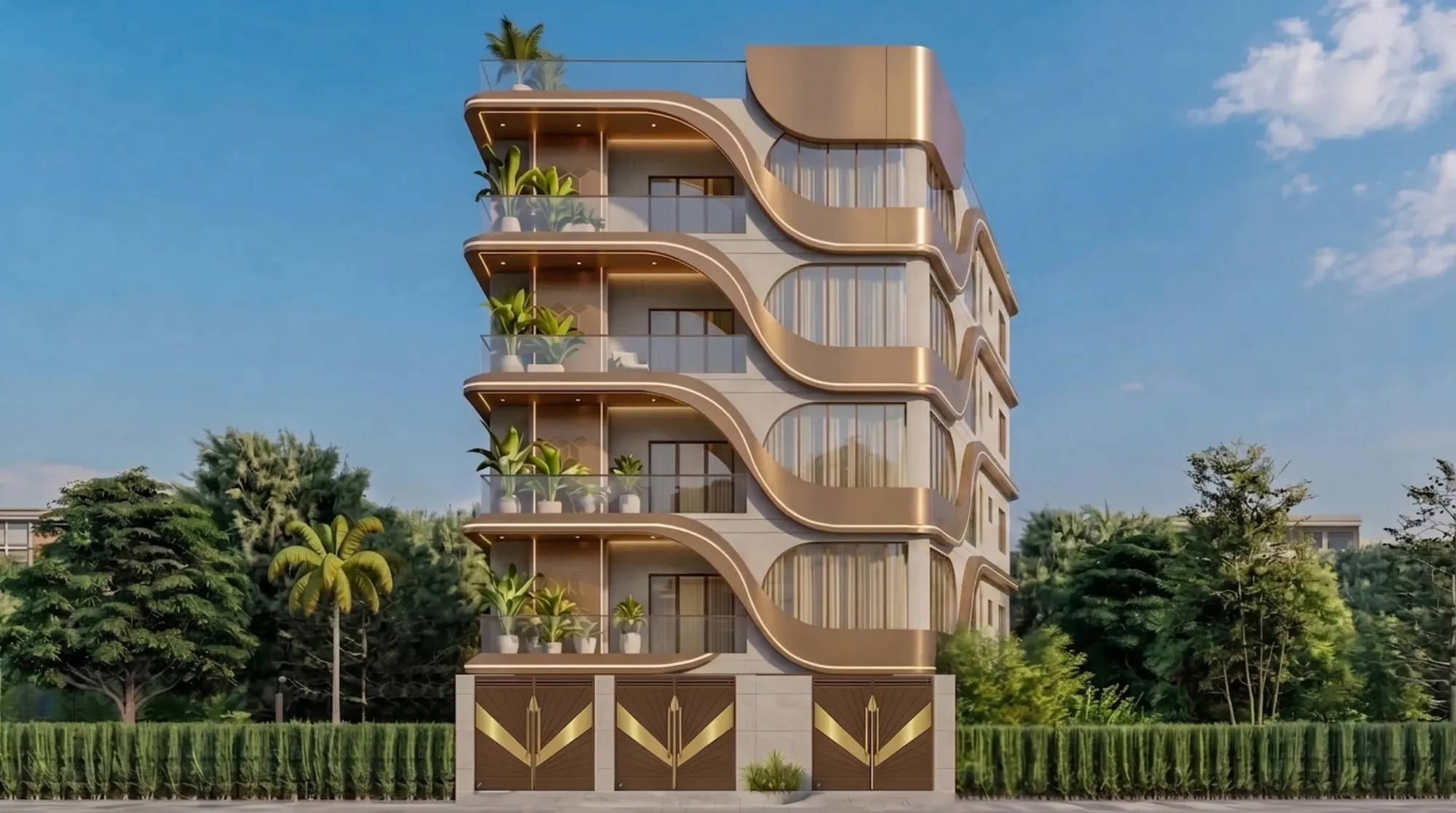
A G+2 residential building on a private plot in New Town is probably the single most common sanction case we handle, and it sits in an awkward middle band, because it is big enough that the authority looks at it properly and small enough that most owners assume it will be a formality. It is not a formality. A ground plus two floors house on a plot in Action Area I, II or III goes through the same NKDA building plan sanction pipeline as anything else, with the same title scrutiny, the same drawing scrutiny, the same structural and services checks, and the same ability to sit stalled for weeks because one page in the file does not agree with another page in the file.
We have been running these files out of our New Town studio since 2014, and across 330+ buildings delivered in New Town, Salt Lake, Rajarhat and greater Kolkata a pattern shows up again and again, which is that the sanction almost never fails on architecture and almost always stalls on paperwork, coordination and internal contradiction. The plan is fine. The elevation is fine. What holds it up is that the land document says one plot area and the survey says another, or the drawing shows a projection nobody accounted for in the coverage calculation, so the file goes back and the clock restarts.
This guide walks through what the G+2 scenario actually involves, the document and drawing set you should expect to assemble, the realistic stage sequence from land papers to sanctioned plan, the specific things that cause rejection in exactly this case, and how our studio runs the process end to end. One important caveat before we start, and it matters more than anything else on this page.
What the G+2 scenario actually involves
A G+2 residential building means ground floor plus two upper floors, and in New Town that usually reads as either a single family house spread vertically, or a ground floor with parking and utility plus two independent floors for family members or rental. That distinction is not cosmetic, because how you use the ground floor changes the coverage arithmetic, the parking provision and sometimes the services layout, so it needs to be decided before drawings go anywhere near submission rather than after.
The sanction question breaks into four buckets that the authority is effectively testing. First, do you have clean, undisputed title and possession over the plot as described in the land documents. Second, does the built form respect the permissible envelope, which is the combination of ground coverage, floor area ratio, height limit and mandatory open space on all sides. Third, is the building structurally and functionally sound as designed, which is where the structural drawings, the soil report where applicable and the services layouts come in. Fourth, is the file internally consistent, which sounds trivial and is where most delay actually lives.
The catch here is that these four buckets are checked by different people at different moments, so an error in bucket one surfaces late and forces rework in buckets two and three. That is why we front-load the land verification before we draw a single wall, and honestly that habit alone has saved clients more calendar time than any drafting speed ever will.
The document set and the drawing set
Think of the submission as two stacks that have to agree with each other perfectly. The paper stack establishes who you are and what you own. The drawing stack establishes what you propose to build. If the plot area in the deed, the area in the survey, the area on the site plan and the area used in your coverage calculation are not the same number, the file will come back, and it will come back for that reason alone even if the design is excellent.
On the paper side you should expect to assemble ownership and title documents for the plot, the allotment or transfer documentation as applicable to how the plot came to you, current tax or assessment records, a recent site survey establishing the actual measured boundaries and dimensions, identity documents for the owner or owners, and the owner declarations and undertakings the authority requires with the application. Where the plot is jointly held, every holder has to be represented correctly, and where there is a power of attorney it has to be valid and produced up front rather than discovered mid-scrutiny.
On the drawing side, a G+2 residential file typically needs a site plan showing the plot with its boundaries, abutting road and proposed setback on every side, floor plans for ground, first and second floors with dimensions and room use marked, at least one elevation and one or two sections cut through the critical parts of the building including the staircase, a terrace or roof plan, structural drawings with foundation details prepared and signed by the structural consultant, and services layouts covering water supply, drainage, septic or sewer connection, rainwater provision and electrical intake as applicable. Alongside the drawings sits the calculation sheet, which is the document that proves your plot area, your covered area, your total floor area, your resulting ratios and your open space provision all reconcile.
- Title and ownership documents for the plot
- Allotment or transfer papers as applicable
- Current tax and assessment records
- Recent measured site survey with boundary dimensions
- Owner identity documents and required declarations
- Site plan with setbacks and abutting road marked
- Floor plans for ground, first and second floors
- Elevation and sections including the staircase
- Terrace and roof plan
- Structural drawings signed by the structural consultant
- Water, drainage and sanitation service layouts
- Area and ratio calculation sheet that reconciles with every drawing
- Architect and structural engineer credentials and signatures
That checklist is deliberately generic on the fine detail, because the exact list and format the authority wants can change, and we would rather you verify the current requirement than trust a web page. If you want the fuller version of this, our documents required for NKDA building sanction guide goes item by item, and the broader NKDA building plan sanction process for New Town guide covers the pipeline for building types beyond a G+2 house.
The realistic stage-by-stage sequence
Here is how it actually runs, as opposed to how people imagine it runs. The imagined version is that you finalise a design you love and then submit it. The real version is that the envelope check comes first, the design happens inside the envelope, and the paperwork runs in parallel from day one so that nothing is waiting on a document that takes three weeks to obtain.
- 01Land and title verification
- 02Site survey and physical measurement
- 03Envelope study against current applicable norms
- 04Concept design frozen inside the envelope
- 05Structural and services coordination
- 06Submission drawing set prepared and signed
- 07Application filed with the authority
- 08Scrutiny and queries answered
- 09Sanction issued
- 10Construction with periodic compliance checks
- 11Completion and occupancy stage
The first three stages are where the money is saved. Verifying title and measuring the plot physically, rather than trusting the deed dimension, tells you whether what you own on paper matches what is fenced on the ground, and in Rajarhat and greater Kolkata that gap is real often enough that we always check. The envelope study then converts the applicable norms into a buildable box for that specific plot, and only after that box exists do we design inside it.
Once the design freezes, structural and services coordination has to happen before the file goes in, not after sanction, because a beam layout that fights the plan or a stack that has nowhere to run will either force a revision later or produce a building that does not match its sanctioned drawings. We normally take clients through a 3D visualisation and rendering pass at this point too, partly because seeing the massing in three dimensions catches proportion and light problems on screen rather than in concrete, and partly because it makes the family confident enough to actually freeze the design instead of revising it after submission.
After filing, the file goes into scrutiny and queries come back. Answering a query well means resubmitting a corrected, internally consistent set, not patching the one sheet that was flagged, because a patched sheet that now disagrees with three other sheets simply generates the next query. At the end of the day, the number of query cycles you go through is the single biggest determinant of how long your sanction takes.
What actually causes rejection or delay in this exact case
We see the same handful of causes over and over on G+2 residential files, and almost none of them are dramatic.
| What owners expect to go wrong | What actually goes wrong |
|---|---|
| The design is too ambitious for the plot | The plot area on the deed does not match the measured survey |
| The authority objects to the elevation | A balcony or projection was never counted in the coverage arithmetic |
| Structural design is questioned | The structural drawings and the architectural plans disagree on a wall or column line |
| Fees are the bottleneck | A joint owner or power of attorney was not correctly represented in the file |
| The rules are impossible | The rules were read from an outdated source instead of confirmed for that plot category |
Taking the big ones in order. Area mismatch is the classic, and it happens because the deed records one figure, the plot as fenced measures another, and nobody reconciles the two before drawing. Uncounted projections come second, where a balcony, a cantilevered slab, a porch or a staircase headroom gets treated as free area in the owner's head and is not free in the calculation, so the covered area quietly exceeds what is permissible. Drawing set contradiction comes third, where the architectural plan and the structural drawing were prepared without proper coordination and the scrutiny catches a column that lands in a doorway.
Then there is the outdated norms problem, which is subtle and expensive. Somebody reads a figure on a forum or in a three year old PDF, designs to it, and discovers at scrutiny that the applicable figure for their plot category or road width is different. This is exactly why we do not publish specific setback or FAR figures as gospel, and why we verify against the current position for every project rather than reusing last year's assumption. Our guide on why building plans get rejected by NKDA unpacks more of these failure modes with the reasoning behind each.
One more that is worth naming, because owners in New Town, Kolkata ask us about it constantly, is the confusion over who is actually qualified to prepare and sign the submission for a building of this scale. That question has a real answer and it depends on the building, and we have written it up separately in our piece on architect versus empanelled engineer for NKDA work rather than compressing it into a paragraph here.
How Studio Contour runs a G+2 sanction
Our working method is boring on purpose, because boring is what gets files through. We open with land and title verification and a physical site survey, and we do not begin design until the plot's real dimensions and the ownership position are both settled. We then run the envelope study for that specific plot against the currently applicable norms, confirmed for that plot rather than assumed, and we hand the client a buildable box with its limits stated plainly.
Design happens inside that box. Sumana Kumar, our principal architect, takes the concept through with the family, and her view on this is straightforward, which is that a house designed to the edge of every permissible limit is usually a worse house than one designed slightly within them, because the compromises you make to claim the last few square feet almost always cost you light, circulation and cross ventilation that you feel every single day. She routinely takes residential and commercial projects through the NKDA, KMC and Bidhannagar Municipal Corporation sanction processes, so the norms are not something we look up at submission time, they are something the design is shaped by from the first sketch.
Structural and services coordination happens before submission, with the structural consultant working off the frozen plan rather than an early draft, so the two sets agree when scrutiny opens them side by side. We prepare and sign the full submission set, file it, and then we own the query cycle, which means we respond to objections with corrected complete sets and we keep the client informed about what was asked and what we changed. We stay involved through construction so the building that gets built matches the building that got sanctioned, which is what makes the completion and occupancy stage later on a much shorter conversation than it usually is.
If you want to see what this produces, our G+2 residence in Action Area II is a fair example of the type, and our residential architecture service page sets out the full scope we cover from feasibility through handover. For a sense of what the architect handles versus what stays with the owner, what architects handle in NKDA plan approval is the honest version of that split.
If you own a plot in New Town and you are working out whether a G+2 is viable on it, the useful first step is not a design, it is an envelope study against the norms that actually apply to your plot, because that tells you what you can build before you fall in love with something you cannot. We do that as a standalone piece of work and it usually resolves the question in a week or two. Bring us your land documents and your plot dimensions and get in touch, and we will tell you plainly what the plot supports, what the sanction route looks like for it, and where we think the risks sit.